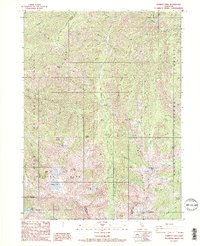
1986 Map of Caribou Lake
USGS Topo · Published 1991About this map
The Salmon Mountains and the high alpine terrain of the Trinity Alps converge on this mid-1980s survey of the Siskiyou and Trinity county border. This landscape is defined by its verticality and historical resource extraction, evidenced by the presence of the Yellow Rose Mine and the Dorleska Mine north of Bullards Basin. The map captures a transition between the Klamath, Shasta, and Trinity National Forest, where high-altitude lakes such as Lower Caribou Lake and Caribou Lake are fed by snowmelt from Snowslide Peak and Caribou Mtn. For the local historian, the inclusion of Lakeview Ranch and a small Cem near the northern boundary provides evidence of early settlement patterns in an otherwise wilderness-dominated corridor along the South Fork Salmon River.
Find a feature on this map
63 named features on this map. Tap any name to fly to it.
Don’t see what you’re looking for? This feature index may not catch every label — zoom into the map to look around manually.
Map Details
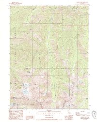
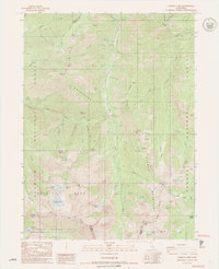
Editions of this 1986 Caribou Lake Map
3 editions found
Other maps of this area

1886 · Shasta
USGS Topo · 1:250,000

1890 · Red Bluff
USGS Topo · 1:250,000

1894 · Red Bluff
USGS Topo · 1:250,000

1894 · Shasta
USGS Topo · 1:250,000

1909 · Big Bar
USGS Topo · 1:96,000

1913 · Weaverville
USGS Topo · 1:125,000

1915 · Big Bar and Vicinity
USGS Topo · 1:250,000

1923 · Sawyers Bar
USGS Topo · 1:125,000

1931 · Etna
USGS Topo · 1:96,000

1934 · Etna
USGS Topo · 1:125,000