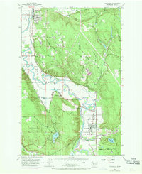
1953 Map of Carnation
USGS Topo · Published 1970About this map
The Snoqualmie River meanders through this agricultural valley, anchoring the riverfront settlements of Carnation and Duvall during the mid-twentieth century. The landscape is defined by the significant infrastructure of the Chicago Milwaukee St Paul and Pacific Railroad and the Great Northern Railroad, which track the water's edge and provide a industrial backbone to the rural terrain. Local landmarks such as Carnation Farm and the Tolt High Sch reflect the community centers of the era, while the expansive Cherry Valley and Tolt Hill Flat show a well-developed network of riverbank roads and drainage systems. Numerous lakes, including Sikes Lake, Ames Lake, and Langlois Lake, dot the valley floor, alongside practical markers of development like Gaging Sta, Water Tank, and a local Gravel Pit.
Find a feature on this map
39 named features on this map. Tap any name to fly to it.
Don’t see what you’re looking for? This feature index may not catch every label — zoom into the map to look around manually.
Map Details
Editions of this 1953 Carnation Map
4 editions found

Other maps of this area

1895 · Snohomish
USGS Topo · 1:125,000

1897 · Seattle
USGS Topo · 1:125,000

1921 · Sultan
USGS Topo · 1:125,000

1923 · Sultan
USGS Topo · 1:125,000

1944 · Everett
USGS Topo · 1:62,500

1950 · Redmond
USGS Topo · 1:24,000

1950 · Issaquah
USGS Topo · 1:24,000

1953 · Snoqualmie
USGS Topo · 1:24,000

1953 · Sultan
USGS Topo · 1:24,000

1953 · Lake Joy
USGS Topo · 1:24,000