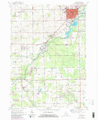
1963 Map of Caro
USGS Topo · Published 1980About this map
The Cass River carves a winding path through the center of this Michigan landscape, anchoring the regional geography of central Tuscola County. The county seat of Caro serves as the primary urban hub, showing a concentrated street grid and industrial features like sewage disposal ponds and the New York Central railroad line. South of the city, the large grounds of the Caro State Hospital and the nearby settlement of Wahjamega reflect the institutional and residential patterns of the early 1960s.
Find a feature on this map
57 named features on this map. Tap any name to fly to it.
Don’t see what you’re looking for? This feature index may not catch every label — zoom into the map to look around manually.
Map Details
Editions of this 1963 Caro Map
3 editions found
Other maps of this area

1954 · Flint
USGS Topo · 1:250,000

1958 · Flint
USGS Topo · 1:250,000

1963 · East Dayton
USGS Topo · 1:24,000

1963 · Mayville
USGS Topo · 1:24,000

1963 · Fairgrove
USGS Topo · 1:24,000

1963 · Ellington
USGS Topo · 1:24,000

1963 · Gilford
USGS Topo · 1:24,000

1963 · Caro
USGS Topo · 1:24,000

1963 · Vassar
USGS Topo · 1:24,000

1963 · Juniata
USGS Topo · 1:24,000