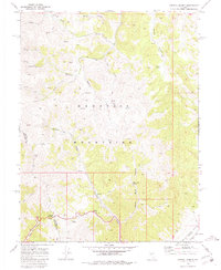
1969 Map of Carroll Summit
USGS Topo · Published 1981About this map
Desatoya Mountains dominate this high-desert landscape, where the ridge lines define the boundary between Churchill and Lander Counties. In this late 1960s survey, the area is characterized by a network of seasonal water sources and canyons, including Billie Canyon and Pole Canyon. The settlement of Carroll Summit sits near the southwestern corner, serving as a critical pass through the range.
Find a feature on this map
30 named features on this map. Tap any name to fly to it.
Don’t see what you’re looking for? This feature index may not catch every label — zoom into the map to look around manually.
Map Details
Editions of this 1969 Carroll Summit Map
3 editions found
Other maps of this area

1955 · Millett
USGS Topo · 1:250,000

1956 · South Shoshone Peak
USGS Topo · 1:62,500

1959 · Millett
USGS Topo · 1:250,000

1969 · Cold Springs
USGS Topo · 1:24,000

1969 · Desatoya Peak
USGS Topo · 1:24,000

1969 · Carroll Summit NE
USGS Topo · 1:24,000

1969 · Carroll Summit
USGS Topo · 1:24,000

1969 · Basque Summit
USGS Topo · 1:24,000
1969 · Carroll Summit SE
USGS Topo · 1:24,000
1969 · Buffalo Summit
USGS Topo · 1:24,000