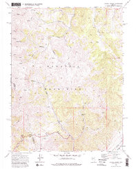
1969 Map of Carroll Summit
USGS Topo · Published 1981About this map
The Desatoya Mountains dominate this 1969 topographic study, straddling the boundary between Churchill and Lander counties. This high-desert landscape is defined by its water sources, with numerous Springs and named sites like White Rock Spring and Dalton Spring providing critical points of reference. The terrain is marked by deep drainages including Billie Canyon and White Rock Canyon, which feed into the wider Smith Creek Valley.
Find a feature on this map
24 named features on this map. Tap any name to fly to it.
Don’t see what you’re looking for? This feature index may not catch every label — zoom into the map to look around manually.
Map Details
Editions of this 1969 Carroll Summit Map
3 editions found
Other maps of this area

1955 · Millett
USGS Topo · 1:250,000

1956 · South Shoshone Peak
USGS Topo · 1:62,500

1959 · Millett
USGS Topo · 1:250,000

1969 · Cold Springs
USGS Topo · 1:24,000

1969 · Desatoya Peak
USGS Topo · 1:24,000

1969 · Carroll Summit NE
USGS Topo · 1:24,000

1969 · Carroll Summit
USGS Topo · 1:24,000

1969 · Basque Summit
USGS Topo · 1:24,000
1969 · Carroll Summit SE
USGS Topo · 1:24,000
1969 · Buffalo Summit
USGS Topo · 1:24,000