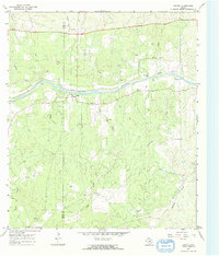
1967 Map of Castell
USGS Topo · Published 1970About this map
The Llano River winds through this central Texas landscape, anchoring the rural settlement of Castell. This 1967 field-checked survey reveals a territory defined by its watercourses and a scattered network of family-named cemeteries and homesteads. The terrain is deeply carved by numerous creeks, including Sand Creek, Elm Creek, and Vasterling Creek, which drain toward the river.
Find a feature on this map
25 named features on this map. Tap any name to fly to it.
Don’t see what you’re looking for? This feature index may not catch every label — zoom into the map to look around manually.
Map Details
Editions of this 1967 Castell Map
2 editions found
Other maps of this area

1887 · Llano
USGS Topo · 1:125,000

1887 · Mason
USGS Topo · 1:125,000

1894 · Mason
USGS Topo · 1:125,000

1894 · Llano
USGS Topo · 1:125,000

1904 · Llano
USGS Topo · 1:125,000

1909 · Llano
USGS Topo · 1:125,000

1918 · Llano
USGS Topo · 1:125,000

1954 · Llano
USGS Topo · 1:250,000

1955 · Llano
USGS Topo · 1:250,000

1955 · Valley Spring
USGS Topo · 1:24,000