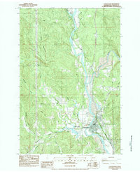
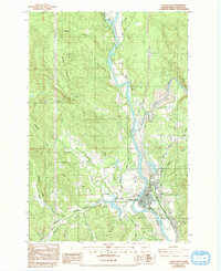
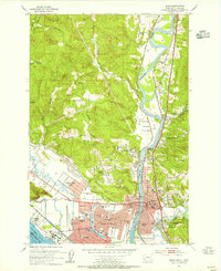
1984 Map of Castle Rock
USGS Topo · Published 1984About this map
Cowlitz River and Toutle River converge in this 1984 survey, framing the settlement of Castle Rock during a period of significant landscape change. The map documents the complex water network of the area, featuring Arkansas Creek and Whittle Creek alongside the prominent Arkansas Valley. The presence of the Burlington Northern railroad and roads like Barnes Drive highlight the regional transportation infrastructure, while an Aband Br suggests shifts in river crossings.
Find a feature on this map
26 named features on this map. Tap any name to fly to it.
Don’t see what you’re looking for? This feature index may not catch every label — zoom into the map to look around manually.
Map Details
Editions of this 1984 Castle Rock Map
2 editions found
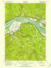
Other maps of this area

1919 · Mayger
USGS Topo · 1:62,500

1921 · Kalama
USGS Topo · 1:62,500

1941 · Olequa
USGS Topo · 1:62,500

1941 · Clatskanie
USGS Topo · 1:62,500
1952 · Clatskanie
USGS Topo · 1:62,500

1953 · Hoquiam
USGS Topo · 1:250,000
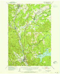
1953 · Castle Rock
USGS Topo · 1:62,500
1953 · Mt. Brynion
USGS Topo · 1:24,000
1953 · Ryderwood
USGS Topo · 1:62,500
1953 · Kelso
USGS Topo · 1:24,000