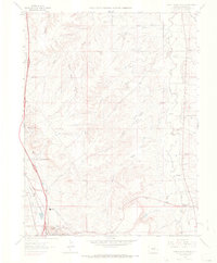
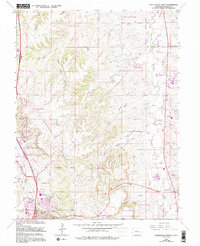
1965 Map of Castle Rock North
USGS Topo · Published 1966About this map
Castle Rock and the settlement at Franktown anchor this mid-1960s study of the northern Douglas County corridor, where the high plains meet the intricate drainage systems of the Front Range. The landscape is defined by the parallel courses of Cherry Creek and Plum Creek, intersected by a network of steep-sided draws including McMurdo Gulch and the ominously named Hangmans Gulch. Two major rail lines, the Denver and Rio Grande Western and the Atchison Topeka and Santa Fe, run adjacent to the growing communities, reflecting the region's long-standing role as a vital transportation artery. Local life is documented through landmarks like the County High School, the Drive-in Theater, and the Pikes Peak Grange, while rural history is preserved at the Fonder Cemetery and scattered resource sites such as the Plateau Quarry.
Find a feature on this map
35 named features on this map. Tap any name to fly to it.
Don’t see what you’re looking for? This feature index may not catch every label — zoom into the map to look around manually.
Map Details
Editions of this 1965 Castle Rock North Map
6 editions found

Other maps of this area

1890 · East Denver
USGS Topo · 1:125,000

1894 · Castle Rock
USGS Topo · 1:125,000

1913 · Castle Rock
USGS Topo · 1:125,000

1935 · East Denver Nos. 3 and 4
USGS Topo · 1:48,000

1939 · Elizabeth
USGS Topo · 1:62,500

1940 · Piney Creek
USGS Topo · 1:24,000

1940 · Castle Rock
USGS Topo · 1:62,500

1942 · Highland Ranch
USGS Topo · 1:31,680

1942 · Parker
USGS Topo · 1:31,680

1942 · Piney Creek
USGS Topo · 1:31,680