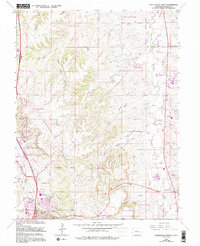
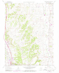
1965 Map of Castle Rock North
USGS Topo · Published 1994About this map
Castle Rock and Franktown anchor this mid-1960s study of the northern Front Range foothills, an area defined by the drainage systems of Cherry Creek and East Plum Creek. The landscape reflects a period of transition as traditional agricultural features like the Pikes Peak Grange and family-named landmarks such as the Fonder Cem meet early suburban developments like Happy Canyon Ranches, Silver Heights, and Richlawn Hills. The topography is marked by a series of north-running gulches, including McMurdo Gulch and Lemon Gulch, which have historically dictated the placement of roads and early ranching boundaries.
Find a feature on this map
46 named features on this map. Tap any name to fly to it.
Don’t see what you’re looking for? This feature index may not catch every label — zoom into the map to look around manually.
Map Details
Editions of this 1965 Castle Rock North Map
6 editions found

Other maps of this area

1890 · East Denver
USGS Topo · 1:125,000

1894 · Castle Rock
USGS Topo · 1:125,000

1913 · Castle Rock
USGS Topo · 1:125,000

1935 · East Denver Nos. 3 and 4
USGS Topo · 1:48,000

1939 · Elizabeth
USGS Topo · 1:62,500

1940 · Piney Creek
USGS Topo · 1:24,000

1940 · Castle Rock
USGS Topo · 1:62,500

1942 · Highland Ranch
USGS Topo · 1:31,680

1942 · Parker
USGS Topo · 1:31,680

1942 · Piney Creek
USGS Topo · 1:31,680