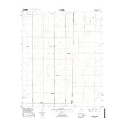
2017 Map of Causey East
USGS Topo · Published 2017About this map
The high plains of the New Mexico-Texas borderlands define this 2017 survey, where the small settlement of Causey sits at a crossroads in the southwestern corner. The landscape is characterized by an orderly grid of county roads that traverse the state line, such as S Roosevelt Road 20 and S Roosevelt Road 25, reflecting the agricultural and ranching legacy of Roosevelt County. Small depressions and playa lakes are scattered across the terrain, showing the natural hydrology of the Llano Estacado. In the immediate vicinity of Causey, residential streets like Sparks St and Merrick Dr mark the village center, while long stretches of Roosevelt Rd E connect the isolated homesteads and pastures of the eastern plains. This map captures the intersection of the Roosevelt-Bailey county line with the international border, providing a clear view of the rural infrastructure in the modern era.
Find a feature on this map
32 named features on this map. Tap any name to fly to it.
Don’t see what you’re looking for? This feature index may not catch every label — zoom into the map to look around manually.
Map Details
Editions of this 2017 Causey East Map
This is the sole edition of this map. No revisions or reprints were ever made.
Other maps of this area

1954 · Clovis
USGS Topo · 1:250,000

1954 · Brownfield
USGS Topo · 1:250,000

1957 · Arch
USGS Topo · 1:62,500

1958 · Brownfield
USGS Topo · 1:250,000

1958 · Clovis
USGS Topo · 1:250,000

1962 · Brownfield
USGS Topo · 1:250,000

1962 · Stegall
USGS Topo · 1:24,000

1968 · Three Way School
USGS Topo · 1:24,000

1969 · Maple
USGS Topo · 1:24,000

1970 · Lingo
USGS Topo · 1:24,000