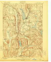
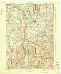
1899 Map of Cazenovia
USGS Topo · Published 1921About this map
Cazenovia Lake sits at the heart of this Central New York landscape, surrounded by a dense network of late-nineteenth-century farmsteads and small upland villages. The area is defined by its deep glacial valleys and the significant water engineering of the era, notably the De Ruyter Reservoir and Erieville Reservoir, which served as critical feeders for the state's canal system. Small rural crossroads like Sheds Corners and Pompey Center are meticulously mapped alongside industrial markers like Stone Quarry Hill and Stone Quarry Falls near Manlius.
Find a feature on this map
60 named features on this map. Tap any name to fly to it.
Don’t see what you’re looking for? This feature index may not catch every label — zoom into the map to look around manually.
Map Details
Editions of this 1899 Cazenovia Map
7 editions found

Other maps of this area

1895 · Chittenango
USGS Topo · 1:62,500

1895 · Syracuse
USGS Topo · 1:62,500

1895 · Oneida
USGS Topo · 1:62,500

1897 · Cazenovia
USGS Topo · 1:62,500

1898 · Oneida
USGS Topo · 1:62,500

1898 · Syracuse
USGS Topo · 1:62,500

1898 · Chittenango
USGS Topo · 1:62,500

1899 · Cazenovia
USGS Topo · 1:62,500

1900 · Tully
USGS Topo · 1:62,500

1902 · Chittenango
USGS Topo · 1:62,500