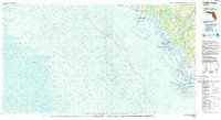
1978 Map of Cedar Keys
USGS Topo · Published 1985About this map
The intricate coastal interface of the Gulf of Mexico defines this late 1970s survey, capturing a landscape dominated by the complex hydrology of the Big Bend region. The Suwannee River delta is a central feature, distributing its waters through Suwannee Sound via outlets like West Gap and Steamboat Gap. These aquatic corridors sustained the fishing and maritime economies of coastal outposts such as Suwannee, Horseshoe Beach, and the resilient island community of Cedar Key.
Find a feature on this map
65 named features on this map. Tap any name to fly to it.
Don’t see what you’re looking for? This feature index may not catch every label — zoom into the map to look around manually.
Map Details
Editions of this 1978 Cedar Keys Map
3 editions found

Other maps of this area

1949 · Apalachicola
USGS Topo · 1:250,000

1954 · Steinhatchee SW
USGS Topo · 1:24,000

1954 · Eugene
USGS Topo · 1:24,000

1954 · Steinhatchee SE
USGS Topo · 1:24,000

1954 · Cross City SW
USGS Topo · 1:24,000

1954 · Horseshoe Beach
USGS Topo · 1:24,000

1954 · Suwannee
USGS Topo · 1:24,000

1954 · Manatee Springs
USGS Topo · 1:24,000

1954 · Chiefland SW
USGS Topo · 1:24,000

1954 · Vista
USGS Topo · 1:24,000