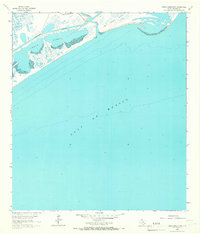
1964 Map of Cedar Lakes East
USGS Topo · Published 1966About this map
San Bernard River waters meet the coastal marshlands along the Texas shoreline in this mid-1960s study of the Brazoria coast. The landscape is defined by the shallow waters of Cedar Lakes and the vital industrial artery of the Intracoastal Waterway, which cuts through the wetlands just behind the barrier beach. Human presence is concentrated along the River Road, where the isolated Ducroz Cem sits near the river's mouth, serving as a quiet marker of early local history.
Find a feature on this map
7 named features on this map. Tap any name to fly to it.
Don’t see what you’re looking for? This feature index may not catch every label — zoom into the map to look around manually.
Map Details
Editions of this 1964 Cedar Lakes East Map
2 editions found
Other maps of this area

1943 · Jones Creek
USGS Topo · 1:31,680

1943 · Freeport
USGS Topo · 1:31,680

1943 · Cedar Lakes East
USGS Topo · 1:24,000

1951 · Bay City
USGS Topo · 1:250,000

1952 · Cedar Lane NE
USGS Topo · 1:24,000

1952 · Cedar Lakes West
USGS Topo · 1:24,000

1956 · Bay City
USGS Topo · 1:250,000

1958 · Bay City
USGS Topo · 1:250,000
1963 · Jones Creek
USGS Topo · 1:24,000
1964 · Freeport
USGS Topo · 1:24,000