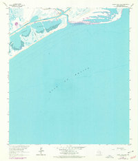
1964 Map of Cedar Lakes East
USGS Topo · Published 1977About this map
The San Bernard River meets the Texas coast in this 1964 survey, revealing a landscape defined by the shifting boundaries of tidal marshes and industrial infrastructure. The coastal barrier system is punctuated by the expansive Cedar Lakes, which are sheltered from the Gulf of Mexico by narrow strips of sand and sediment. This era of the Brazoria coast shows the critical role of the Intracostal Waterway as it cuts behind the beachfront, facilitating maritime transit through the low-lying wetlands. Evidence of local family history is anchored by the Ducroz Cem located near the riverbanks, while the presence of a Pipeline indicates the growing petroleum industry influence on the coastal geography during the mid-20th century. The map provides an essential record of the shoreline before subsequent decades of erosion and development altered the mouth of the river.
Find a feature on this map
6 named features on this map. Tap any name to fly to it.
Don’t see what you’re looking for? This feature index may not catch every label — zoom into the map to look around manually.
Map Details
Editions of this 1964 Cedar Lakes East Map
2 editions found
Other maps of this area

1943 · Jones Creek
USGS Topo · 1:31,680

1943 · Freeport
USGS Topo · 1:31,680

1943 · Cedar Lakes East
USGS Topo · 1:24,000

1951 · Bay City
USGS Topo · 1:250,000

1952 · Cedar Lane NE
USGS Topo · 1:24,000

1952 · Cedar Lakes West
USGS Topo · 1:24,000

1956 · Bay City
USGS Topo · 1:250,000

1958 · Bay City
USGS Topo · 1:250,000
1963 · Jones Creek
USGS Topo · 1:24,000
1964 · Freeport
USGS Topo · 1:24,000