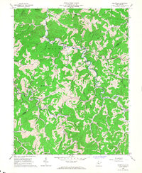
1966 Map of Cedarville
USGS Topo · Published 1967About this map
Cedar Creek State Park occupies the northwest corner of this mid-1960s survey, representing a significant portion of the local landscape alongside the Cedar Creek and Steer Creek watersheds. The area is defined by a dense network of winding runs and forks, including Leatherbark Run and Walker Fork, which dictate the placement of small communities and family landmarks. The map records an active energy landscape, with numerous Gas Wells and Oil Wells peppered throughout the hills, particularly around Flower and the Glenville border.
Find a feature on this map
62 named features on this map. Tap any name to fly to it.
Don’t see what you’re looking for? This feature index may not catch every label — zoom into the map to look around manually.
Map Details
Editions of this 1966 Cedarville Map
2 editions found
Other maps of this area

1893 · Sutton
USGS Topo · 1:125,000

1906 · Glenville
USGS Topo · 1:62,500

1906 · Burnsville
USGS Topo · 1:62,500

1908 · Gassaway
USGS Topo · 1:48,000

1908 · Sutton
USGS Topo · 1:48,000

1910 · Sutton Special
USGS Topo · 1:62,500

1910 · Gassaway
USGS Topo · 1:62,500

1925 · Glenville
USGS Topo · 1:62,500

1925 · Burnsville
USGS Topo · 1:62,500

1927 · Burnsville
USGS Topo · 1:62,500