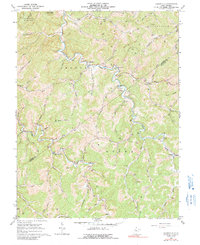
1966 Map of Cedarville
USGS Topo · Published 1991About this map
The border of Gilmer and Braxton counties defines the rolling West Virginia landscape of the mid-1960s, a region where life and industry centered on the winding courses of Cedar Creek and the Left Fork Steer Creek. The small settlement of Cedarville stands as a local hub near Rockcamp Run, while the surrounding hills are dotted with numerous Gas Wells and Oil Wells, signaling the area's deep ties to energy extraction. To the northwest, Cedar Creek State Park preserves the headwaters of Sugarcamp Run. The social fabric of this era is clearly visible through its small, family-associated landmarks, including Rhodes Chapel, Otterbein Ch, and the Rutherford Cem. These country churches and cemeteries, often named for early settlers like Waldeck Ch or Gerwig Ch, reveal the generational roots of the families working the hollows and ridges.
Find a feature on this map
61 named features on this map. Tap any name to fly to it.
Don’t see what you’re looking for? This feature index may not catch every label — zoom into the map to look around manually.
Map Details
Editions of this 1966 Cedarville Map
2 editions found
Other maps of this area

1893 · Sutton
USGS Topo · 1:125,000

1906 · Glenville
USGS Topo · 1:62,500

1906 · Burnsville
USGS Topo · 1:62,500

1908 · Gassaway
USGS Topo · 1:48,000

1908 · Sutton
USGS Topo · 1:48,000

1910 · Sutton Special
USGS Topo · 1:62,500

1910 · Gassaway
USGS Topo · 1:62,500

1925 · Glenville
USGS Topo · 1:62,500

1925 · Burnsville
USGS Topo · 1:62,500

1927 · Burnsville
USGS Topo · 1:62,500