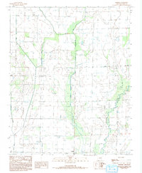
1984 Map of Central
USGS Topo · Published 1993About this map
Agricultural development and water management define this portion of Cross County during the early 1980s. The landscape is characterized by an extensive network of drainage and irrigation, including the prominent Irr Canal and various siphons that traverse the low-lying terrain. The L'Anguille River meanders through the eastern section, joined by smaller waterways such as Black Fork and Brushy Creek. This area, photographed in 1980 and field-checked in 1982, shows the rural community of Central and the settlement of Tilton at a time when the region's economy was deeply tied to its hydrology and soil. Local genealogists and historians can trace the paths of First Creek and Second Creek as they intersect the township lines of T 9 N, T 8 N, and T 7 N, illustrating the cadastral organization of these Arkansas wetlands.
Find a feature on this map
10 named features on this map. Tap any name to fly to it.
Don’t see what you’re looking for? This feature index may not catch every label — zoom into the map to look around manually.
Map Details
Editions of this 1984 Central Map
2 editions found
Other maps of this area

1939 · Vanndale
USGS Topo · 1:62,500

1939 · Wynne
USGS Topo · 1:62,500

1939 · Hunter
USGS Topo · 1:62,500

1940 · Tilton
USGS Topo · 1:62,500

1953 · Memphis
USGS Topo · 1:250,000

1956 · Memphis
USGS Topo · 1:250,000

1956 · Tilton
USGS Topo · 1:62,500

1956 · Hunter
USGS Topo · 1:62,500

1958 · Hunter
USGS Topo · 1:62,500

1958 · Wynne
USGS Topo · 1:62,500