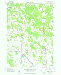
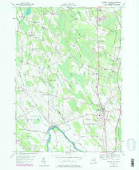
1956 Map of Central Square
USGS Topo · Published 1978About this map
The Oneida River and its bordering wetlands define the southern boundary of this Oswego County landscape, where the waters of Oneida Lake transition into the river system. During the mid-1950s, the village of Central Square served as a key junction for the New York Central and New York Ontario and Western railroads. This network of rails and rural roads connected numerous family-named hamlets and corners, reflecting a long-established agricultural pattern of small crossroads settlements like Peat Corners, Benders Corners, and Stewart Corners.
Find a feature on this map
92 named features on this map. Tap any name to fly to it.
Don’t see what you’re looking for? This feature index may not catch every label — zoom into the map to look around manually.
Map Details
Editions of this 1956 Central Square Map
5 editions found
Other maps of this area

1895 · Syracuse
USGS Topo · 1:62,500

1898 · Syracuse
USGS Topo · 1:62,500

1900 · Baldwinsville
USGS Topo · 1:62,500

1900 · Fulton
USGS Topo · 1:62,500

1905 · Mexico
USGS Topo · 1:62,500

1940 · Brewerton
USGS Topo · 1:24,000

1940 · Cicero
USGS Topo · 1:24,000

1943 · New Haven
USGS Topo · 1:31,680
1943 · Mallory
USGS Topo · 1:31,680

1943 · Brewerton
USGS Topo · 1:31,680