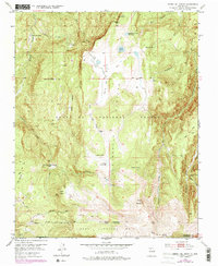
1953 Map of Cerro Del Grant
USGS Topo · Published 1978About this map
Santa Fe National Forest encompasses the high country of Rio Arriba and Sandoval counties, where the high-altitude topography is defined by significant volcanic features and alpine meadows. The southern portion of the map is dominated by the Baca Location No 1 land grant boundary, a reminder of the complex land tenure systems in northern New Mexico. Human presence in this environment is represented by the La Grulla Ranch and the Upper Coyote Creek Sawmill, suggesting a history tied to timber and ranching.
Find a feature on this map
38 named features on this map. Tap any name to fly to it.
Don’t see what you’re looking for? This feature index may not catch every label — zoom into the map to look around manually.
Map Details
Editions of this 1953 Cerro Del Grant Map
3 editions found

Other maps of this area

1890 · Jemes
USGS Topo · 1:125,000

1892 · Jemes
USGS Topo · 1:125,000

1892 · Santa Clara
USGS Topo · 1:125,000

1909 · Gallina
USGS Topo · 1:125,000

1918 · Abiquiu
USGS Topo · 1:125,000

1937 · Jemez Springs
USGS Topo · 1:48,000

1944 · Jemez Springs
USGS Topo · 1:62,500

1952 · Valle Toledo
USGS Topo · 1:24,000

1952 · Jemez Springs
USGS Topo · 1:62,500

1953 · Canones
USGS Topo · 1:24,000