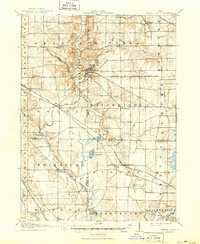
1908 Map of Chagrin Falls
USGS Topo · Published 1950About this map
Chagrin Falls serves as the focal point of this early twentieth-century landscape, where the Chagrin River and McFarland Creek shape the drainage patterns of eastern Cuyahoga and Geauga counties. The map captures the region during a critical transition in transportation, showing the heavy reliance on rail networks like the Cleveland and Garrettsville Electric RR and the Erie and Wheeling and Lake Erie RR.
Find a feature on this map
50 named features on this map. Tap any name to fly to it.
Don’t see what you’re looking for? This feature index may not catch every label — zoom into the map to look around manually.
Map Details
Editions of this 1908 Chagrin Falls Map
2 editions found

Other maps of this area

1901 · Euclid
USGS Topo · 1:62,500

1903 · Cleveland
USGS Topo · 1:62,500

1903 · Euclid
USGS Topo · 1:62,500

1903 · Akron
USGS Topo · 1:62,500

1904 · Chardon
USGS Topo · 1:62,500

1905 · Akron
USGS Topo · 1:62,500

1905 · Garrettsville
USGS Topo · 1:62,500

1905 · Mentor
USGS Topo · 1:62,500

1906 · Chardon
USGS Topo · 1:62,500

1906 · Kent
USGS Topo · 1:62,500