
1961 Map of Chambers Island
USGS Topo · Published 1972About this map
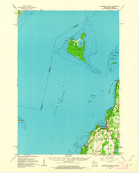
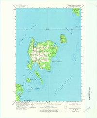
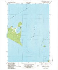
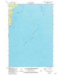
Chambers Island dominates this portion of Green Bay, featuring the interior Mackaysee Lake and Mud Lake alongside a Landing Strip and the Chambers Island Lighthouse. To the east, the Door County shoreline reveals the established patterns of mid-century coastal life, where the community of Egg Harbor serves as a focal point near Juddville. This survey, compiled from 1954 aerial photography and 1961 field checks, records a landscape defined by maritime navigation and rural infrastructure. Along the mainland, genealogists can locate landmarks such as School No 1, Sunny Point Sch, and the Evangelical Ch, while the maritime environment is marked by the Strawberry Islands and the long reach of Hanover Shoal. The presence of several Gravel Pits and a Quarry near Juddville Bay indicates the localized extraction industries supporting the peninsula's growth during this era.
Find a feature on this map
40 named features on this map. Tap any name to fly to it.
Don’t see what you’re looking for? This feature index may not catch every label — zoom into the map to look around manually.
Map Details
Editions of this 1961 Chambers Island Map
2 editions found
Historical Maps of Jacksonport Through Time
43 maps found

1960 Jacksonport
Door County, WI
1960 Washington Island
Door County, WI
1961 Chambers Island
Door County, WI

1978 Brussels
Door County, WI
1978 Namur
Door County, WI

1981 Idlewild
Door County, WI

1981 Institute
Door County, WI
1981 Sturgeon Bay East
Door County, WI

1981 Sturgeon Bay West
Door County, WI

1982 Algoma NE
Door County, WI

1982 Baileys Harbor East
Door County, WI

1982 Baileys Harbor West
Door County, WI
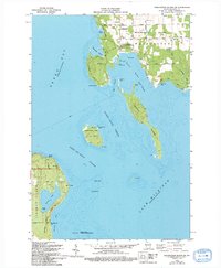
1982 Chambers Island
Door County, WI

1982 Green Island
Door County, WI

1982 Jacksonport
Door County, WI

1982 Jacksonport SW
Door County, WI

1982 Little Sturgeon SW
Door County, WI
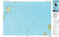
1982 Spider Island
Door County, WI
1982 Washington Island NE
Door County, WI
1982 Washington Island NW
Door County, WI
1982 Washington Island SE
Door County, WI
1982 Washington Island SW
Door County, WI
1984 Washington Island
Door County, WI

2022 Algoma NE
Door County, WI

2022 Baileys Harbor East
Door County, WI

2022 Baileys Harbor West
Door County, WI

2022 Brussels
Door County, WI

2022 Chambers Island
Door County, WI

2022 Chambers Island NW
Door County, WI

2022 Green Island
Door County, WI

2022 Idlewild
Door County, WI

2022 Institute
Door County, WI

2022 Jacksonport
Door County, WI

2022 Jacksonport SW
Door County, WI

2022 Little Sturgeon SW
Door County, WI

2022 Namur
Door County, WI
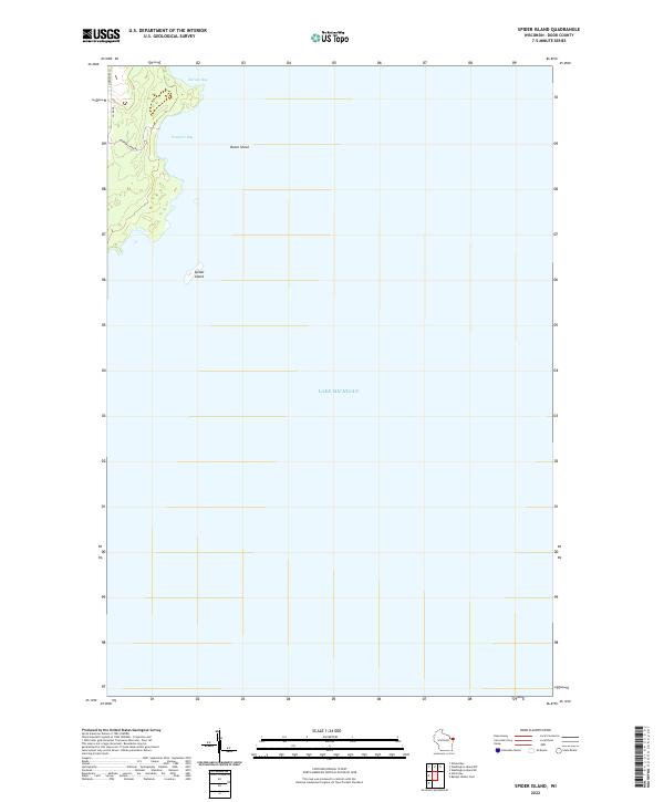
2022 Spider Island
Door County, WI

2022 Sturgeon Bay East
Door County, WI

2022 Sturgeon Bay West
Door County, WI

2022 Washington Island NE
Door County, WI

2022 Washington Island NW
Door County, WI

2022 Washington Island SE
Door County, WI

2022 Washington Island SW
Door County, WI