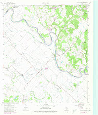
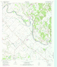
1962 Map of Chances Store
USGS Topo · Published 1980About this map
The Brazos River meanders along the border of Brazos and Burleson counties, defining a landscape of fertile bottoms and winding waterways. This area, surveyed in 1962 with later revisions, shows a rural economy centered on local hubs like Chances Store and Fosters Store. To the northwest, the Texas A & M University Research Annex occupies a significant tract of land near the river bend, while the small settlement of Grant sits further west. The topography is largely defined by numerous bayous and creeks, including Butler Bayou and Middle Bayou, which create a complex drainage pattern through the low-lying terrain. Scattered rural institutions like Jones High Sch and Newsome Cem provide valuable evidence of mid-century community life. The presence of a Gravel Pit and a Radio Tower near Silver Hill highlights the gradual introduction of industrial and communications infrastructure into this riverine environment.
Find a feature on this map
31 named features on this map. Tap any name to fly to it.
Don’t see what you’re looking for? This feature index may not catch every label — zoom into the map to look around manually.
Map Details
Editions of this 1962 Chances Store Map
5 editions found
Other maps of this area

1914 · Gay Hill
USGS Topo · 1:62,500

1954 · Austin
USGS Topo · 1:250,000

1956 · Bryan
USGS Topo · 1:62,500

1956 · Caldwell
USGS Topo · 1:62,500

1956 · Somerville
USGS Topo · 1:62,500

1959 · Clay
USGS Topo · 1:24,000

1960 · Lyons
USGS Topo · 1:24,000
1960 · Snook
USGS Topo · 1:24,000

1961 · Mumford
USGS Topo · 1:24,000

1961 · Wellborn
USGS Topo · 1:24,000