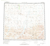
1956 Map of Chandler Lake
USGS Topo · Published 1975About this map
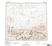
Anaktuvuk Pass serves as a critical mountain corridor through the Brooks Range in this mid-century survey of Alaska's northern wilderness. The landscape is defined by the Continental Divide, where the waters of the Anaktuvuk River and Chandler River begin their respective journeys. Evidence of human activity is concentrated at the pass, marked by a Landing Area, a Cem, and a Tractor Trail that cuts through the valley. The terrain transitions from the high peaks of the Endicott Mountains, including Mount MacVicar and Mount Stuver, to the broad mesas and bluffs further north, such as Hatbox Mesa and Sivugak Bluff. This era of documentation highlights the remote outposts of the Arctic, pinpointing isolated Cabins and traditional landmarks like Gunsight Mtn and Ear Peak before modern infrastructure altered the navigation of these mountain reaches.
Find a feature on this map
116 named features on this map. Tap any name to fly to it.
Don’t see what you’re looking for? This feature index may not catch every label — zoom into the map to look around manually.
Map Details
Editions of this 1956 Chandler Lake Map
8 editions found

Other maps of this area

1951 · Sagavanirktok D-5
USGS Topo · 1:250,000

1951 · Ikpikpuk River
USGS Topo · 1:250,000

1951 · Survey Pass
USGS Topo · 1:250,000

1951 · Chandler Lake
USGS Topo · 1:250,000

1951 · Chandalar
USGS Topo · 1:250,000

1951 · Brooks
USGS Topo · 1:250,000

1951 · Killik River
USGS Topo · 1:250,000

1951 · Wiseman
USGS Topo · 1:250,000

1952 · Umiat
USGS Topo · 1:250,000

1955 · Umiat A-4
USGS Topo · 1:63,360