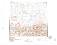
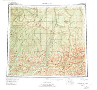
1956 Map of Chandler Lake
USGS Topo · Published 1987About this map
The Continental Divide cuts through the southern reaches of this high-latitude landscape, where the Brooks Range transitions into the North Slope's sweeping river valleys. Rivers like the Ayiyak River, Tuluga River, and Nanushuk River flow northward from the mountain peaks, following a drainage pattern established long before the formal designation of the Gates of the Arctic National Park and its surrounding wilderness areas.
Find a feature on this map
75 named features on this map. Tap any name to fly to it.
Don’t see what you’re looking for? This feature index may not catch every label — zoom into the map to look around manually.
Map Details
Editions of this 1956 Chandler Lake Map
8 editions found

Other maps of this area

1951 · Sagavanirktok D-5
USGS Topo · 1:250,000

1951 · Ikpikpuk River
USGS Topo · 1:250,000

1951 · Survey Pass
USGS Topo · 1:250,000

1951 · Chandler Lake
USGS Topo · 1:250,000

1951 · Chandalar
USGS Topo · 1:250,000

1951 · Brooks
USGS Topo · 1:250,000

1951 · Killik River
USGS Topo · 1:250,000

1951 · Wiseman
USGS Topo · 1:250,000

1952 · Umiat
USGS Topo · 1:250,000

1955 · Umiat A-4
USGS Topo · 1:63,360