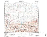
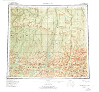
1956 Map of Chandler Lake
USGS Topo · Published 1987About this map
Anaktuvuk River flows northward through the heart of this landscape, carving a major corridor through the Endicott Mountains and the broader Brooks Range. This 1950s era survey captures the region as the Gates of the Arctic National Park and surrounding wilderness areas were being formally defined. High-altitude landmarks like Gunsight Mtn and Mount Macvicar dominate the southern half, while the northern reaches transition into the distinct bluffs of Hatbox Mesa and Ayiyak Mesa.
Find a feature on this map
79 named features on this map. Tap any name to fly to it.
Don’t see what you’re looking for? This feature index may not catch every label — zoom into the map to look around manually.
Map Details
Editions of this 1956 Chandler Lake Map
8 editions found

Other maps of this area

1951 · Sagavanirktok D-5
USGS Topo · 1:250,000

1951 · Ikpikpuk River
USGS Topo · 1:250,000

1951 · Survey Pass
USGS Topo · 1:250,000

1951 · Chandler Lake
USGS Topo · 1:250,000

1951 · Chandalar
USGS Topo · 1:250,000

1951 · Brooks
USGS Topo · 1:250,000

1951 · Killik River
USGS Topo · 1:250,000

1951 · Wiseman
USGS Topo · 1:250,000

1952 · Umiat
USGS Topo · 1:250,000

1955 · Umiat A-4
USGS Topo · 1:63,360