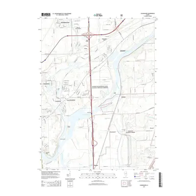
2015 Map of Channahon
USGS Topo · Published 2015About this map
The confluence of the DuPage River and Des Plaines River dominates this Will County landscape, illustrating a region defined by its water routes and conservation lands. The Illinois and Michigan Canal National Heritage Corridor traces the historic path of commerce through Channahon and Millsdale, while to the southeast, the expansive Midewin National Forest protects a significant portion of the tallgrass prairie ecosystem.
Find a feature on this map
143 named features on this map. Tap any name to fly to it.
Don’t see what you’re looking for? This feature index may not catch every label — zoom into the map to look around manually.
Map Details
Editions of this 2015 Channahon Map
This is the sole edition of this map. No revisions or reprints were ever made.
Other maps of this area

1892 · Morris
USGS Topo · 1:62,500

1892 · Joliet
USGS Topo · 1:62,500

1892 · Wilmington
USGS Topo · 1:62,500

1918 · Wilmington
USGS Topo · 1:62,500

1918 · Morris
USGS Topo · 1:62,500

1923 · Joliet
USGS Topo · 1:62,500

1925 · Yorkville
USGS Topo · 1:62,500

1953 · Yorkville SE
USGS Topo · 1:24,000

1953 · Coal City
USGS Topo · 1:24,000

1953 · Symerton
USGS Topo · 1:24,000