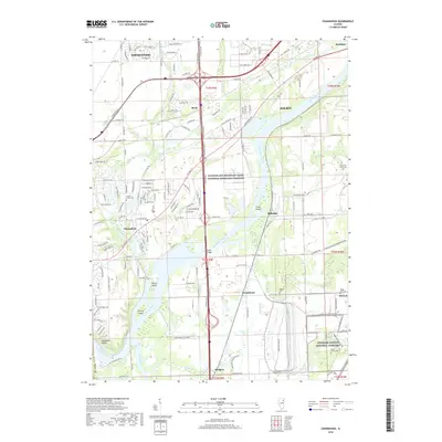
2018 Map of Channahon
USGS Topo · Published 2018About this map
The confluence of the Des Plaines River and DuPage River defines this industrial and memorial landscape in Will County. This modern survey illustrates the expansive Abraham Lincoln National Cemetery and the protected Illinois and Michigan Canal National Heritage Corridor, documenting the preservation of both local history and the natural waterway system.
Find a feature on this map
48 named features on this map. Tap any name to fly to it.
Don’t see what you’re looking for? This feature index may not catch every label — zoom into the map to look around manually.
Map Details
Editions of this 2018 Channahon Map
This is the sole edition of this map. No revisions or reprints were ever made.
Other maps of this area

1892 · Morris
USGS Topo · 1:62,500

1892 · Joliet
USGS Topo · 1:62,500

1892 · Wilmington
USGS Topo · 1:62,500

1918 · Wilmington
USGS Topo · 1:62,500

1918 · Morris
USGS Topo · 1:62,500

1923 · Joliet
USGS Topo · 1:62,500

1925 · Yorkville
USGS Topo · 1:62,500

1953 · Yorkville SE
USGS Topo · 1:24,000

1953 · Coal City
USGS Topo · 1:24,000

1953 · Symerton
USGS Topo · 1:24,000