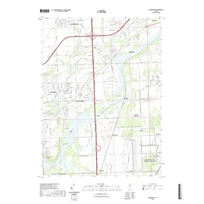
2021 Map of Channahon
USGS Topo · Published 2021About this map
The confluence of the Du Page River and the Des Plaines River anchors this landscape southwest of Joliet, where industrial developments and memorial grounds meet. The southern portion of the map is dominated by the Abraham Lincoln National Cemetery, a significant site of local and national memory situated near the historic Reed's Grove Cem. Residential expansion is evident in Shorewood and Minooka, while older industrial footprints are marked by the Dow Chemical Entrance and the settlement at Drummond. River navigation and transport remain central to the area's identity, with features like Treat Island, Moose Island, and the Smith Bridge illustrating the complex waterways that have long dictated the placement of towns like Channahon and Blodgett.
Find a feature on this map
200 named features on this map. Tap any name to fly to it.
Don’t see what you’re looking for? This feature index may not catch every label — zoom into the map to look around manually.
Map Details
Editions of this 2021 Channahon Map
This is the sole edition of this map. No revisions or reprints were ever made.
Other maps of this area

1892 · Morris
USGS Topo · 1:62,500

1892 · Joliet
USGS Topo · 1:62,500

1892 · Wilmington
USGS Topo · 1:62,500

1918 · Wilmington
USGS Topo · 1:62,500

1918 · Morris
USGS Topo · 1:62,500

1923 · Joliet
USGS Topo · 1:62,500

1925 · Yorkville
USGS Topo · 1:62,500

1953 · Yorkville SE
USGS Topo · 1:24,000

1953 · Coal City
USGS Topo · 1:24,000

1953 · Symerton
USGS Topo · 1:24,000