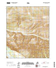
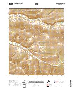
2018 Map of Charley River B-5 NW
USGS Topo · Published 2018About this map
Yukon-Charley Rivers National Preserve encompasses the majority of this landscape, protecting a vast stretch of Alaskan wilderness shaped by the drainage of the Yukon River. The topography is defined by the steep, upland drainages of the Eureka Cr basin, where the water cuts through complex terrain in the northeastern interior of the state. This 2018 survey provides an modern look at the preservation area before it transitions into the adjacent townships of T7N and T8N. The absence of roads or permanent settlements highlights the protected status of this corridor, where the land remains largely as it was during the early conservation efforts that established the preserve.
Find a feature on this map
9 named features on this map. Tap any name to fly to it.
Don’t see what you’re looking for? This feature index may not catch every label — zoom into the map to look around manually.
Map Details
Editions of this 2018 Charley River B-5 NW Map
This is the sole edition of this map. No revisions or reprints were ever made.
Other maps of this area

1951 · Charley River
USGS Topo · 1:250,000

1956 · Charley River C-5
USGS Topo · 1:63,360

1956 · Charley River C-6
USGS Topo · 1:63,360

1956 · Charley River B-6
USGS Topo · 1:63,360

1956 · Charley River B-5
USGS Topo · 1:63,360

1956 · Charley River
USGS Topo · 1:250,000
2018 · Charley River B-5 SW
USGS Topo · 1:25,000
2018 · Charley River B-5 NE
USGS Topo · 1:25,000
2018 · Charley River C-5 SW
USGS Topo · 1:25,000
2018 · Charley River C-5 SE
USGS Topo · 1:25,000