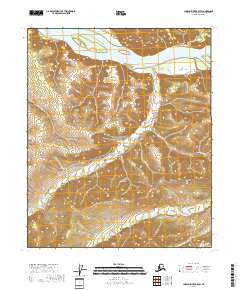
2018 Map of Charley River B-5 SW
USGS Topo · Published 2018About this map
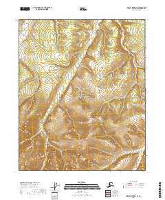
The Yukon River dominates the northern reaches of this landscape within the Yukon-Charley Rivers National Preserve. The terrain south of the river is defined by a dense network of drainages and topographical features such as Alice Gulch and Green Gulch. This area is historically significant for its gold-mining legacy, as evidenced by the naming of various tributaries including Woodchopper Cr, Slate Cr, Mineral Cr, and Coal Cr. The map details the intricate elevation changes leading toward the high point at Dome in the southeast, reflecting the complex drainage patterns of the upper Yukon basin. The absence of modern roads emphasizes the protected and wild character of the preserve during this period of the early twenty-first century.
Find a feature on this map
15 named features on this map. Tap any name to fly to it.
Don’t see what you’re looking for? This feature index may not catch every label — zoom into the map to look around manually.
Map Details
Editions of this 2018 Charley River B-5 SW Map
This is the sole edition of this map. No revisions or reprints were ever made.
Other maps of this area

1951 · Charley River
USGS Topo · 1:250,000

1956 · Charley River B-6
USGS Topo · 1:63,360

1956 · Charley River A-5
USGS Topo · 1:63,360

1956 · Charley River B-5
USGS Topo · 1:63,360

1956 · Charley River A-6
USGS Topo · 1:63,360

1956 · Charley River
USGS Topo · 1:250,000
2018 · Charley River B-5 NE
USGS Topo · 1:25,000
2018 · Charley River B-5 NW
USGS Topo · 1:25,000
2018 · Charley River A-5 NW
USGS Topo · 1:25,000
2018 · Charley River B-6 SE
USGS Topo · 1:25,000