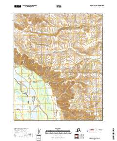
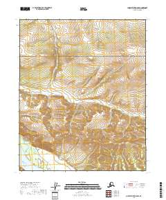
2018 Map of Charley River C-6 SE
USGS Topo · Published 2018About this map
Yukon-Charley Rivers National Preserve encompasses most of this landscape, where the massive Yukon River cuts through the southwestern corner of the quadrangle. The river's broad channel and adjacent wetlands form a distinct ecological corridor against the higher terrain to the east and north. In the upper portion of the map, the Little Black River meanders across a plateau-like region, reflecting a drainage pattern typical of the Alaskan interior where water bodies navigate between subtle elevation changes. This 2018 survey illustrates a region defined by its lack of modern infrastructure, preserving the natural state of the Yukon-Koyukuk Census Area. The topography is shaped by the interplay of these major water systems, which have historically served as the primary transit routes through this wilderness long before established roads or air travel became common.
Find a feature on this map
8 named features on this map. Tap any name to fly to it.
Don’t see what you’re looking for? This feature index may not catch every label — zoom into the map to look around manually.
Map Details
Editions of this 2018 Charley River C-6 SE Map
This is the sole edition of this map. No revisions or reprints were ever made.
Other maps of this area

1951 · Charley River
USGS Topo · 1:250,000

1956 · Charley River C-5
USGS Topo · 1:63,360

1956 · Charley River C-6
USGS Topo · 1:63,360

1956 · Charley River B-6
USGS Topo · 1:63,360

1956 · Charley River B-5
USGS Topo · 1:63,360

1956 · Charley River
USGS Topo · 1:250,000
2018 · Charley River C-5 NW
USGS Topo · 1:25,000
2018 · Charley River C-6 NE
USGS Topo · 1:25,000
2018 · Charley River C-5 SW
USGS Topo · 1:25,000
2018 · Charley River B-5 NW
USGS Topo · 1:25,000