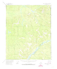
1956 Map of Charley River D-1
USGS Topo · Published 1974About this map
Charley River meanders across the lower portion of this 1956 terrain study, tracing a path through the wilderness just west of the United States Canada border. This region, captured via photogrammetric methods from 1955 aerial photography, is defined by its complex drainage systems and unique permafrost formations. The presence of Pingos highlights the specific Arctic geomorphology of the area, offering a rare look at these earth-covered ice mounds as they were documented in the mid-1950s. Tributaries such as Bull Creek, Midnight Creek, and Surveyor Creek feed into the larger river system, illustrating the watershed of the eastern interior before modern environmental changes. The map provides a critical record of the Alaska Yukon boundary, where surveying control was established by the International Boundary Commission and the U.S. Geological Survey.
Find a feature on this map
7 named features on this map. Tap any name to fly to it.
Don’t see what you’re looking for? This feature index may not catch every label — zoom into the map to look around manually.
Map Details
Editions of this 1956 Charley River D-1 Map
2 editions found
Other maps of this area

1951 · Charley River
USGS Topo · 1:250,000

1951 · Black River
USGS Topo · 1:250,000
1956 · Black River A-1
USGS Topo · 1:63,360

1956 · Black River A-2
USGS Topo · 1:63,360

1956 · Charley River C-2
USGS Topo · 1:63,360
1956 · Charley River C-1
USGS Topo · 1:63,360

1956 · Black River
USGS Topo · 1:250,000

1956 · Charley River D-2
USGS Topo · 1:63,360
1956 · Charley River D-1
USGS Topo · 1:63,360

1956 · Charley River
USGS Topo · 1:250,000