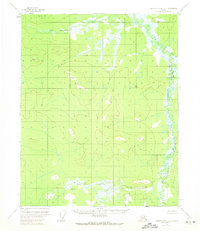
1956 Map of Charley River D-3
USGS Topo · Published 1972About this map
Black River dominates the eastern boundary of this 1950s interior Alaskan landscape, winding through a complex network of wetlands and small ponds. The terrain rises sharply to the west, defined by the prominent peaks of Bear Mountain and Fanny Mtn, providing a stark contrast to the low-lying river valley. In the north, near the confluence of several unnamed tributaries, small Cabins indicate the presence of seasonal trappers or hunters in this otherwise unroaded wilderness.
Find a feature on this map
9 named features on this map. Tap any name to fly to it.
Don’t see what you’re looking for? This feature index may not catch every label — zoom into the map to look around manually.
Map Details
Editions of this 1956 Charley River D-3 Map
2 editions found
Other maps of this area

1951 · Charley River
USGS Topo · 1:250,000

1951 · Black River
USGS Topo · 1:250,000

1956 · Black River A-2
USGS Topo · 1:63,360

1956 · Black River A-4
USGS Topo · 1:63,360

1956 · Black River A-3
USGS Topo · 1:63,360
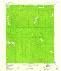
1956 · Charley River D-4
USGS Topo · 1:63,360

1956 · Charley River C-2
USGS Topo · 1:63,360

1956 · Charley River D-3
USGS Topo · 1:63,360

1956 · Black River
USGS Topo · 1:250,000

1956 · Charley River C-4
USGS Topo · 1:63,360