
1970 Map of Chelsea
USGS Topo · Published 1972About this map
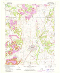
Extensive extraction operations characterize the Rogers County landscape around the town of Chelsea and the settlement of Alluwe at the start of the 1970s. The terrain is marked by numerous Strip Mines and concentrated Oil Wells, reflecting a period of heavy industrial activity. In the northwest, the rising waters of the Oologah Reservoir back up into Panther Creek, significantly altering the local geography.
Find a feature on this map
32 named features on this map. Tap any name to fly to it.
Don’t see what you’re looking for? This feature index may not catch every label — zoom into the map to look around manually.
Map Details
Editions of this 1970 Chelsea Map
3 editions found
Other maps of this area

1896 · Pryor
USGS Topo · 1:125,000

1901 · Claremore
USGS Topo · 1:125,000

1901 · Nowata
USGS Topo · 1:125,000

1901 · Vinita
USGS Topo · 1:125,000

1901 · Pryor
USGS Topo · 1:125,000

1913 · Vinita
USGS Topo · 1:125,000

1914 · Nowata
USGS Topo · 1:125,000

1914 · Claremore
USGS Topo · 1:125,000

1916 · Claremore
USGS Topo · 1:125,000

1954 · Tulsa
USGS Topo · 1:250,000