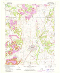
1970 Map of Chelsea
USGS Topo · Published 1982About this map
Chelsea sits at the heart of this landscape, a center of commerce and transport where the Burlington Northern railroad corridor and local highways intersect. The surrounding terrain is heavily defined by extraction and water management, featuring numerous Strip Mines and active Oil Wells that speak to the region's industrial foundations during the late 20th century. To the west, the expansive reach of Oologah Lake and the Chelsea Reservoir dominate the hydrology, while Pryor Creek meanders through the eastern sections.
Find a feature on this map
37 named features on this map. Tap any name to fly to it.
Don’t see what you’re looking for? This feature index may not catch every label — zoom into the map to look around manually.
Map Details
Editions of this 1970 Chelsea Map
3 editions found

Other maps of this area

1896 · Pryor
USGS Topo · 1:125,000

1901 · Claremore
USGS Topo · 1:125,000

1901 · Nowata
USGS Topo · 1:125,000

1901 · Vinita
USGS Topo · 1:125,000

1901 · Pryor
USGS Topo · 1:125,000

1913 · Vinita
USGS Topo · 1:125,000

1914 · Nowata
USGS Topo · 1:125,000

1914 · Claremore
USGS Topo · 1:125,000

1916 · Claremore
USGS Topo · 1:125,000

1954 · Tulsa
USGS Topo · 1:250,000