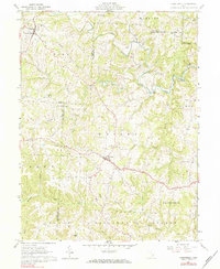
1961 Map of Chesterhill
USGS Topo · Published 1984About this map
The ridge-and-valley landscape of southeastern Ohio is prominently displayed in this early 1960s study, where the borders of Morgan, Washington, and Athens counties converge. The village of Chesterhill anchors the northwestern corner, while the surrounding townships of Marion, Windsor, and Wesley are dotted with numerous rural congregations and resting places, such as Tabor Ch, Bethel Ridge Ch, and the Quaker Cem.
Find a feature on this map
47 named features on this map. Tap any name to fly to it.
Don’t see what you’re looking for? This feature index may not catch every label — zoom into the map to look around manually.
Map Details
Editions of this 1961 Chesterhill Map
4 editions found
Other maps of this area

1902 · Parkersburg
USGS Topo · 1:62,500

1904 · Parkersburg
USGS Topo · 1:62,500

1904 · Chesterhill
USGS Topo · 1:62,500

1906 · Chesterhill
USGS Topo · 1:62,500

1909 · Caldwell
USGS Topo · 1:62,500

1910 · Mc Connelsville
USGS Topo · 1:62,500

1912 · Caldwell
USGS Topo · 1:62,500

1949 · Clarksburg
USGS Topo · 1:250,000

1956 · Clarksburg
USGS Topo · 1:250,000

1960 · Watertown
USGS Topo · 1:24,000