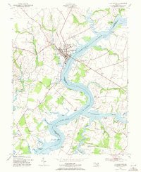
1953 Map of Chestertown
USGS Topo · Published 1971About this map
The Chestertown riverfront and the surrounding tidewater landscape of the Eastern Shore are documented here following early 1950s revisions. The town center serves as the focal point, featuring the Washington College campus and the industrial trace of the Pennsylvania railroad line. The map highlights a river-based economy transitioning toward mid-century leisure, evidenced by the Drive-in Theater near Union Ch and the Chester River Country Club.
Find a feature on this map
69 named features on this map. Tap any name to fly to it.
Don’t see what you’re looking for? This feature index may not catch every label — zoom into the map to look around manually.
Map Details
Editions of this 1953 Chestertown Map
4 editions found
Other maps of this area

1898 · Tolchester
USGS Topo · 1:125,000

1899 · Dover
USGS Topo · 1:125,000

1900 · Cecilton
USGS Topo · 1:62,500

1900 · Betterton
USGS Topo · 1:62,500

1901 · Chestertown
USGS Topo · 1:62,500

1903 · Tolchester
USGS Topo · 1:125,000

1905 · Barclay
USGS Topo · 1:62,500

1906 · Dover
USGS Topo · 1:125,000

1908 · Tolchester
USGS Topo · 1:125,000

1920 · Dover
USGS Topo · 1:125,000