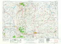
1954 Map of Cheyenne
USGS Topo · Published 1966About this map
Cheyenne and Laramie serve as the primary anchors for this mid-century topographic survey, showing the region during a period of significant military and infrastructure development. The Union Pacific railroad cuts a vital path across the high plains, connecting small whistle-stops and settlements like Buford, Tie Siding, and Granite Canon. The city of Cheyenne is shown in detail, including the State Capitol, St Marys Cathedral, and the sprawling grounds of Francis E Warren Air Force Base. To the west, the Laramie Mountains dominate the horizon, with specific peaks like Pole Mountain and Pilot Hill rising above the basin. The map reveals a landscape managed for conservation and defense, featuring the Medicine Bow National Forest and the Pole Mountain Military Reservation, alongside vital water resources such as Wheatland Reservoir No 2 and the winding Laramie River.
Find a feature on this map
122 named features on this map. Tap any name to fly to it.
Don’t see what you’re looking for? This feature index may not catch every label — zoom into the map to look around manually.
Map Details
Editions of this 1954 Cheyenne Map
3 editions found

Other maps of this area

1895 · Laramie
USGS Topo · 1:125,000

1896 · Patrick
USGS Topo · 1:125,000

1896 · Hartville
USGS Topo · 1:125,000

1898 · Scotts Bluff
USGS Topo · 1:125,000

1899 · Goshen Hole
USGS Topo · 1:125,000

1899 · Whistle Creek
USGS Topo · 1:125,000

1901 · Hartville
USGS Topo · 1:125,000

1902 · Laramie
USGS Topo · 1:125,000

1905 · Sherman
USGS Topo · 1:125,000

1905 · Laramie
USGS Topo · 1:125,000