
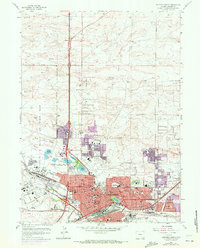
1961 Map of Cheyenne North
USGS Topo · Published 1964About this map
The sprawling northern reach of Cheyenne at the start of the 1960s is defined by its strategic military and aviation hubs. The Francis E Warren Air Force Base dominates the western edge, adjacent to the extensive grounds of Frontier Park and the Cheyenne Country Club. This era shows a city in transition, with mid-century residential expansion pushing northward past Sloan Lake and Lake Absarraca. The urban landscape is densely marked by community infrastructure, including numerous educational sites like Central High Sch and McCormick Jr High Sch, and healthcare facilities such as the Veterans Administration Hospital.
Find a feature on this map
133 named features on this map. Tap any name to fly to it.
Don’t see what you’re looking for? This feature index may not catch every label — zoom into the map to look around manually.
Map Details
Editions of this 1961 Cheyenne North Map
3 editions found
Other maps of this area

1911 · Cheyenne
USGS Topo · 1:125,000

1914 · Cheyenne
USGS Topo · 1:125,000

1950 · Cheyenne
USGS Topo · 1:62,500

1954 · Cheyenne
USGS Topo · 1:250,000

1958 · Cheyenne
USGS Topo · 1:250,000

1961 · Round Top Lake
USGS Topo · 1:24,000

1961 · Cheyenne South
USGS Topo · 1:24,000
1961 · Borie
USGS Topo · 1:24,000

1961 · Cheyenne
USGS Topo · 1:62,500

1962 · P O Ranch
USGS Topo · 1:24,000