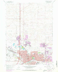
1961 Map of Cheyenne North
USGS Topo · Published 1978About this map
Cheyenne serves as the focal point of this survey, capturing the city during a period of significant mid-century expansion into its northern outskirts. The map illustrates the convergence of major transportation corridors, where Interstate 25 and Interstate 80 meet historic rail lines like the Union Pacific and the Colorado And Southern. The urban landscape is anchored by civic and cultural landmarks including the State Capitol, the Museum, and the sprawling grounds of Frontier Park (Rodeo Ground), home to the city's celebrated rodeo traditions.
Find a feature on this map
120 named features on this map. Tap any name to fly to it.
Don’t see what you’re looking for? This feature index may not catch every label — zoom into the map to look around manually.
Map Details
Editions of this 1961 Cheyenne North Map
3 editions found
Other maps of this area

1911 · Cheyenne
USGS Topo · 1:125,000

1914 · Cheyenne
USGS Topo · 1:125,000

1950 · Cheyenne
USGS Topo · 1:62,500

1954 · Cheyenne
USGS Topo · 1:250,000

1958 · Cheyenne
USGS Topo · 1:250,000

1961 · Round Top Lake
USGS Topo · 1:24,000

1961 · Cheyenne South
USGS Topo · 1:24,000
1961 · Borie
USGS Topo · 1:24,000

1961 · Cheyenne
USGS Topo · 1:62,500

1961 · Cheyenne North
USGS Topo · 1:24,000