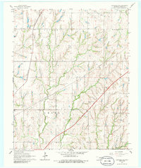
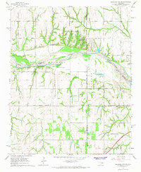
1966 Map of Chickasha NE
USGS Topo · Published 1986About this map
West Bitter Creek and East Bitter Creek carve a series of parallel valleys across this Oklahoma landscape, defining the drainage patterns of the Amber and Vincent districts. The 1960s infrastructure is dominated by the diagonal slash of the H E Bailey Toll Road Turnpike, which cuts across the established section lines and the older corridor of the St Louis-San Francisco railroad. Near the western edge, the Amber Sch and a nearby Reservoir mark the community center of the Amber area, while the small settlement of Sooner sits along the rail line to the north. Numerous Pipelines crisscross the terrain between the creeks, highlighting the region's mid-century role in energy transport, alongside local industry like the Gravel Pit in the northeast corner of the Waldron township.
Find a feature on this map
14 named features on this map. Tap any name to fly to it.
Don’t see what you’re looking for? This feature index may not catch every label — zoom into the map to look around manually.
Map Details
Editions of this 1966 Chickasha NE Map
2 editions found
Other maps of this area

1893 · Oklahoma City
USGS Topo · 1:62,500

1893 · Minco
USGS Topo · 1:62,500

1904 · Chickasha
USGS Topo · 1:125,000

1954 · Oklahoma City
USGS Topo · 1:250,000

1956 · Oklahoma City
USGS Topo · 1:62,500

1957 · Oklahoma City
USGS Topo · 1:250,000

1963 · Oklahoma City
USGS Topo · 1:250,000
1965 · Dibble
USGS Topo · 1:24,000
1965 · Blanchard
USGS Topo · 1:24,000
1965 · Oklahoma City SW
USGS Topo · 1:24,000