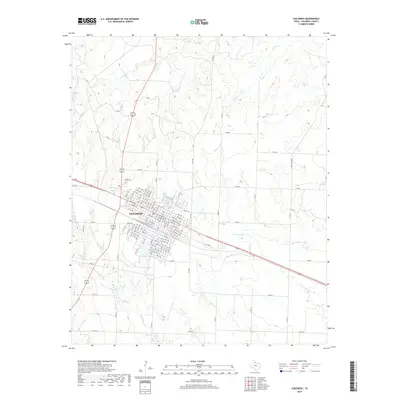
2019 Map of Childress
USGS Topo · Published 2019About this map
Childress serves as the focal point of this Panhandle landscape, where the town's grid is defined by numbered avenues and streets that transition into a network of farm-to-market and county roads. The terrain is characterized by a complex drainage system, with the headwaters and branches of N Groesbeck Cr and Conkline Cr carving through the plains. Local water management is evident in features like Lake Scott and Park Lake, which sit on the periphery of the primary settlement. The map reveals how the modern transportation corridors of Ranch Rd 2184 and various county roads, such as Co RD 16, trace the historic agricultural divides of Childress County. This 2019 survey documents the intersection of rural life and hydrological features like Scatterbranch Cr and Whites Cr, illustrating the enduring spatial organization of this North Texas community.
Find a feature on this map
117 named features on this map. Tap any name to fly to it.
Don’t see what you’re looking for? This feature index may not catch every label — zoom into the map to look around manually.
Map Details
Editions of this 2019 Childress Map
This is the sole edition of this map. No revisions or reprints were ever made.
Other maps of this area

1954 · Plainview
USGS Topo · 1:250,000

1958 · Plainview
USGS Topo · 1:250,000

1960 · Loco
USGS Topo · 1:62,500

1961 · Estelline
USGS Topo · 1:62,500

1967 · Buckle L Ranch
USGS Topo · 1:24,000

1967 · Hell Roaring Creek
USGS Topo · 1:24,000

1967 · Kirkland South
USGS Topo · 1:24,000

1967 · Kirkland North
USGS Topo · 1:24,000

1967 · Childress
USGS Topo · 1:24,000

1967 · Carey
USGS Topo · 1:24,000