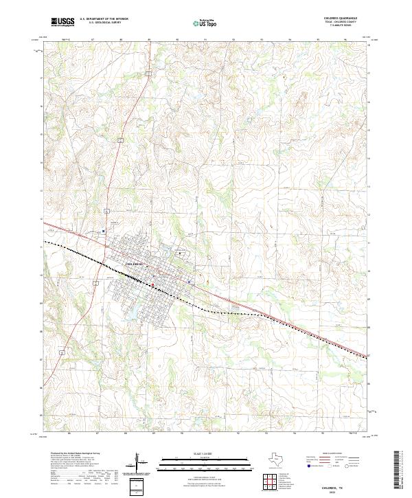
2022 Map of Childress
USGS Topo · Published 2022About this map
Childress serves as the focal point of this Panhandle landscape, where the town's grid is anchored by the Childress County Courthouse. The residential blocks extend north and west, featuring named thoroughfares like Ave L NW and Ave I NW. Significant local landmarks include the Childress Cem on the northern edge of the settlement and the recreational waters of Park Lake and Lake Scott to the south. The surrounding terrain is defined by a network of drainage systems, including Scatterbranch Cr, Conkline Cr, and N Groesbeck Cr, which cut through the high plains. The map details the transition from the concentrated urban streets of the county seat to the sprawling agricultural rural routes like Co Rd S and Co Rd AA.
Find a feature on this map
73 named features on this map. Tap any name to fly to it.
Don’t see what you’re looking for? This feature index may not catch every label — zoom into the map to look around manually.
Map Details
Editions of this 2022 Childress Map
This is the sole edition of this map. No revisions or reprints were ever made.
Other maps of this area

1954 · Plainview
USGS Topo · 1:250,000

1958 · Plainview
USGS Topo · 1:250,000

1960 · Loco
USGS Topo · 1:62,500

1961 · Estelline
USGS Topo · 1:62,500

1967 · Buckle L Ranch
USGS Topo · 1:24,000

1967 · Hell Roaring Creek
USGS Topo · 1:24,000

1967 · Kirkland South
USGS Topo · 1:24,000

1967 · Kirkland North
USGS Topo · 1:24,000

1967 · Childress
USGS Topo · 1:24,000

1967 · Carey
USGS Topo · 1:24,000