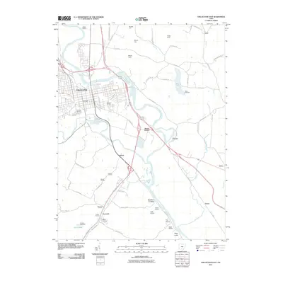
2010 Map of Chillicothe East
USGS Topo · Published 2010About this map
The Scioto River and its confluence with Paint Creek define the geography of this part of Ross County. The eastern portion of Chillicothe occupies the northwest, where the grid of city streets meets several large burial grounds, including Grandview Cemetery and Greenlawn Cemetery. Moving southeast along the river valley, the landscape transitions from urban centers to a network of smaller named settlements such as Renick, Schrader, and Massieville.
Find a feature on this map
66 named features on this map. Tap any name to fly to it.
Don’t see what you’re looking for? This feature index may not catch every label — zoom into the map to look around manually.
Map Details
Editions of this 2010 Chillicothe East Map
This is the sole edition of this map. No revisions or reprints were ever made.
Other maps of this area

1906 · Waverly
USGS Topo · 1:62,500

1906 · Chillicothe
USGS Topo · 1:62,500

1908 · Chillicothe
USGS Topo · 1:62,500

1908 · Waverly
USGS Topo · 1:62,500

1912 · Roxabell
USGS Topo · 1:62,500

1914 · Roxabell
USGS Topo · 1:62,500

1915 · Piketon
USGS Topo · 1:62,500

1917 · Piketon
USGS Topo · 1:62,500

1944 · Piketon
USGS Topo · 1:62,500

1944 · Roxabell
USGS Topo · 1:62,500