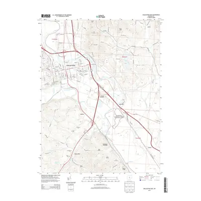
2013 Map of Chillicothe East
USGS Topo · Published 2013About this map
Chillicothe and its surrounding river valley are documented here in the early twenty-first century, anchored by the winding course of the Scioto River. This landscape is deeply shaped by its indigenous history, most notably at the Hopewell Culture National Historical Park, situated along the riverbanks south of the city center. The settlement patterns follow the valley floor, with Renick and Massieville connected by the modern highway corridors of US-23 and US-50. Family and community history is preserved in numerous burial grounds, including Greenlawn Cem and Grandview Cem near the urban core, and the smaller Findley Cem and Hamilton Cem in the outlying areas. The terrain rises sharply from the river bottom to prominent heights like Mt Logan and Mt Ives, while the southeastern corner is defined by a network of drainage systems including Indian Creek and the curiously named Deadman Crossing.
Find a feature on this map
94 named features on this map. Tap any name to fly to it.
Don’t see what you’re looking for? This feature index may not catch every label — zoom into the map to look around manually.
Map Details
Editions of this 2013 Chillicothe East Map
This is the sole edition of this map. No revisions or reprints were ever made.
Other maps of this area

1906 · Waverly
USGS Topo · 1:62,500

1906 · Chillicothe
USGS Topo · 1:62,500

1908 · Chillicothe
USGS Topo · 1:62,500

1908 · Waverly
USGS Topo · 1:62,500

1912 · Roxabell
USGS Topo · 1:62,500

1914 · Roxabell
USGS Topo · 1:62,500

1915 · Piketon
USGS Topo · 1:62,500

1917 · Piketon
USGS Topo · 1:62,500

1944 · Piketon
USGS Topo · 1:62,500

1944 · Roxabell
USGS Topo · 1:62,500