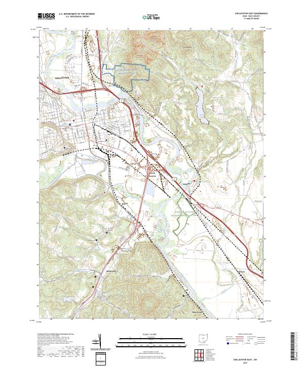
2023 Map of Chillicothe East
USGS Topo · Published 2023About this map
The Scioto River defines the western edge of this landscape, winding past the eastern neighborhoods of Chillicothe and the Ross County Courthouse. The city's grid gives way to the broader river valley where the Hopewell Culture National Historical Park preserves ancient earthworks. To the north, the NG Camp Sherman Joint Training Center sits at the foot of Mt Logan, a prominent height overlooking the valley.
Find a feature on this map
141 named features on this map. Tap any name to fly to it.
Don’t see what you’re looking for? This feature index may not catch every label — zoom into the map to look around manually.
Map Details
Editions of this 2023 Chillicothe East Map
This is the sole edition of this map. No revisions or reprints were ever made.
Other maps of this area

1906 · Waverly
USGS Topo · 1:62,500

1906 · Chillicothe
USGS Topo · 1:62,500

1908 · Chillicothe
USGS Topo · 1:62,500

1908 · Waverly
USGS Topo · 1:62,500

1912 · Roxabell
USGS Topo · 1:62,500

1914 · Roxabell
USGS Topo · 1:62,500

1915 · Piketon
USGS Topo · 1:62,500

1917 · Piketon
USGS Topo · 1:62,500

1944 · Piketon
USGS Topo · 1:62,500

1944 · Roxabell
USGS Topo · 1:62,500