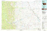
1984 Map of Choteau
USGS Topo · Published 1984About this map
The Sawtooth Range meets the plains in this 1980s-era study of the Rocky Mountain Front. The landscape is defined by the sharp contrast between the Bob Marshall Wilderness to the west and the developed agricultural lands to the east, where the Burlington Northern railroad links smaller settlements like Agawam and Bynum. Water management is central to the region's character, evidenced by a string of significant reservoirs including Pishkun Reservoir, Willow Creek Reservoir, and Bynum Reservoir that support both local irrigation and numerous wildlife management areas. Local history and genealogy interests are well-served by the mapping of distinct Hutterite communities such as Miller Colony and New Rockport Colony, while the presence of Freezeout Lake and the Teton Spring Creek State Bird Preserve underscores the area's importance as a migratory corridor.
Find a feature on this map
136 named features on this map. Tap any name to fly to it.
Don’t see what you’re looking for? This feature index may not catch every label — zoom into the map to look around manually.
Map Details
Editions of this 1984 Choteau Map
This is the sole edition of this map. No revisions or reprints were ever made.
Other maps of this area

1886 · Great Falls
USGS Topo · 1:250,000

1902 · Ovando
USGS Topo · 1:125,000

1903 · Saypo
USGS Topo · 1:125,000

1903 · Coopers Lake
USGS Topo · 1:125,000

1905 · Ovando
USGS Topo · 1:125,000

1913 · Marias Pass
USGS Topo · 1:125,000

1914 · Heart Butte
USGS Topo · 1:125,000

1918 · Heart Butte
USGS Topo · 1:125,000

1920 · Choteau
USGS Topo · 1:125,000

1920 · Dupuyer
USGS Topo · 1:125,000