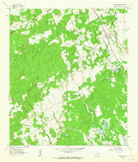
1962 Map of Chriesman
USGS Topo · Published 1964About this map
The community of Chriesman sits at the intersection of rural life and transit in the early 1960s, defined by the Gulf Colorado and Santa Fe railroad corridor. The landscape is heavily marked by the drainage systems of Davidson Creek and its many tributaries, including Second Davidson Creek and Porter Branch. This survey documents a quiet rural economy where scattered Oil Well locations and Gravel Pits dot the countryside. For those researching local history, the map provides precise locations for the Liberty Ch and Shiloh Sch, alongside several family and community burial grounds such as Cox Cem and Shiloh Cem. An Old Railroad Grade north of Bowers Lake indicates a changing transportation network, while the developing Cade Lakes area suggests a shift toward recreational water features in the southern half of the quadrangle.
Find a feature on this map
26 named features on this map. Tap any name to fly to it.
Don’t see what you’re looking for? This feature index may not catch every label — zoom into the map to look around manually.
Map Details
Editions of this 1962 Chriesman Map
Other maps of this area

1919 · Dime Box
USGS Topo · 1:62,500

1954 · Austin
USGS Topo · 1:250,000

1956 · Caldwell
USGS Topo · 1:62,500

1956 · Milano
USGS Topo · 1:62,500

1956 · Somerville
USGS Topo · 1:62,500
1960 · Tanglewood
USGS Topo · 1:24,000
1960 · Frenstat
USGS Topo · 1:24,000
1960 · Deanville
USGS Topo · 1:24,000
1961 · Caldwell
USGS Topo · 1:24,000

1961 · Rockdale East
USGS Topo · 1:24,000