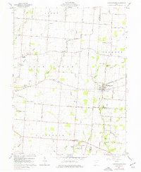
1961 Map of Christiansburg
USGS Topo · Published 1977About this map
Christiansburg stands as the primary hub in this agricultural landscape at the junction of Miami, Champaign, and Clark counties. The settlement pattern is defined by a dense network of family-named cemeteries and rural institutions, including Sodom Ch and Honey Creek Ch. The terrain is deeply inscribed with the drainage patterns of Honey Creek, Indian Creek, and Lost Creek, which weave through the townships of Lost Creek, Elizabeth, and Brown.
Find a feature on this map
54 named features on this map. Tap any name to fly to it.
Don’t see what you’re looking for? This feature index may not catch every label — zoom into the map to look around manually.
Map Details
Editions of this 1961 Christiansburg Map
3 editions found
Other maps of this area

1904 · Springfield
USGS Topo · 1:62,500

1904 · Dayton
USGS Topo · 1:62,500

1906 · Dayton
USGS Topo · 1:62,500

1906 · Springfield
USGS Topo · 1:62,500

1914 · Troy
USGS Topo · 1:62,500

1914 · St. Paris
USGS Topo · 1:62,500

1916 · St. Paris
USGS Topo · 1:62,500

1944 · St. Paris
USGS Topo · 1:62,500

1944 · Troy
USGS Topo · 1:62,500

1947 · Columbus
USGS Topo · 1:250,000