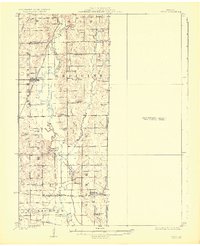
1924 Map of Chula
USGS Topo · Published 1924About this map
Medicine Creek and its meandering tributaries, including Muddy Creek, define the agricultural landscape of this northern Missouri region in the early 1920s. The map reveals a dense network of local education and community life, with numerous rural schoolhouses such as Banner School, Prairie Valley School, and the aptly named Brush College School serving scattered farmsteads. Settlement is concentrated along the rail lines, where the Chicago Milwaukee and St Paul intersects with the local economy at Chula, while the Chicago Burlington and Quincy passes through Wheeling to the south.
Find a feature on this map
52 named features on this map. Tap any name to fly to it.
Don’t see what you’re looking for? This feature index may not catch every label — zoom into the map to look around manually.
Map Details
Editions of this 1924 Chula Map
3 editions found
Other maps of this area

1921 · Chillicothe
USGS Topo · 1:62,500

1923 · Chillicothe
USGS Topo · 1:62,500

1924 · Dawn
USGS Topo · 1:62,500

1924 · Chula
USGS Topo · 1:62,500

1924 · Hale
USGS Topo · 1:62,500

1946 · Brookfield
USGS Topo · 1:62,500

1946 · Galt
USGS Topo · 1:62,500

1947 · Chula
USGS Topo · 1:62,500

1948 · Brookfield
USGS Topo · 1:62,500

1948 · Trenton
USGS Topo · 1:62,500